There is a new paper on DEM terminology and definitions (open access):
Guth, P.L., Niekerk, A.V., Grohmann, C.H., Muller, J.-P., Hawker, L., Florinsky, I.V., Gesch, D., Reuter, H.I., Herrera-Cruz, V., Riazanoff, S., Lópéz-Vázquez, C., Carabajal, C.C., Albinet, C., Strobl, P., 2021 - Digital Elevation Models: Terminology and Definitions. Remote Sensing, 13(18):3581. https://doi.org/10.3390/rs13183581
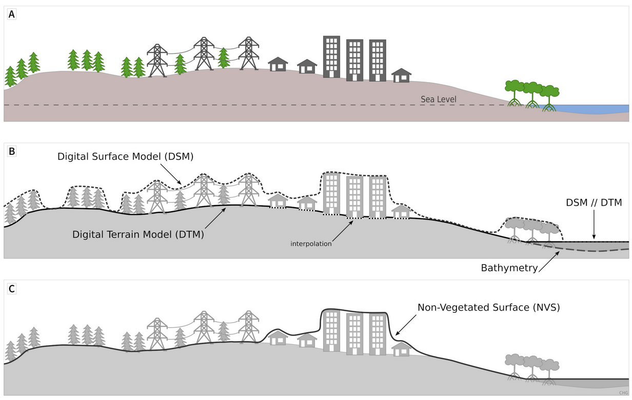
The paper is the first major contribution of the DEMIX project (DEM Intercomparison EXercise). The idea is to “consolidate terminology and definitions of key concepts to facilitate a common understanding among the growing community of DEM users, who do not necessarily share the same background”.

Scheme showing the surfaces represented by a DSM, a DTM, and a NVS (Guth et al., 2021)


