
Geomorphometry 2015: Conference and Workshops
Geomorphometry for natural hazards geomodelling
HONORARY PATRONAGE
JM Prof. Dr Hab. Bronisław Marciniak,
Rector of Adam Mickiewicz University in Poznań
Dr Inż. Kazimierz Bujakowski,
Surveyor General of Poland
Geomorphometry 2015 became a history. On behalf of organizing committee I would like to thank to all Geomorphometry 2015 Participants. It was a great pleasure to host all of you in Poznań. Regardless of the committee’s work, participants are the key to the success of the conference. Many interesting talks, posters and discussions is that what is worth the effort during the preparation. We wish all many valuable publications resulting from the conference meeting and we wish success to the organisers of the next meeting.THANK YOU!
Here you will find a few pictures from the conference (Google Photos)
PROGRAM CHAIRS
- Zbigniew Zwoliński, Institute of Geoecology and Geoinformation, Poland
- Jarosław Jasiewicz, Institute of Geoecology and Geoinformation, Poland
- Helena Mitasova, North Carolina State University, NC, USA
- Tomislav Hengl, ISRIC / Wageningen University and Research, the Netherlands
Conference secretariat:
Director: Zbigniew Zwoliński
Head of GIS Lab, Chair of the International Association of Geomorphologists
Working Group on Landform Assessment for Geodiversity
Dzięgielowa 27#214 60-680 Poznań, Poland
phone: +48618296176
Vice-director: Jarosław Jasiewicz
Institute of Geoecology and Geoinformation
Dzięgielowa 27#221 60-680 Poznań, Poland
phone: +48618296196
Conference Treasurer: Magdalena Ratajczak-Szczerba,
Secretariat: Joanna Gudowicz, Alicja Najwer, Jakub Nowosad
Field trip organizers: Małgorzata Mazurek, Miroslaw Makohonienko
Book of Proceedings
KEYNOTE SPEAKERS
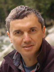 |
Marco Giardino, School of Natural Sciences, University of Torino, Italy: “Multidimensional approach to natural instabilities in mountain areas: how geomorphometry can improve both hazard modelling and risk perception” |
 |
Markus Metz, GRASS Development Team, Fondazione Edmund Mach, Trento, Italy: “Searching for water: hydrological modelling concepts in GRASS GIS” |
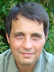 |
Lucian Drăguţ, West University of Timisoara, Romania: “Object-oriented geomorphometry” |
INVITED LECTURES
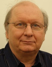 |
Tomasz Stepinski, Space Informatics Lab, University of Cincinnati, Ohio, United States: “Doing Geomorphometry with Pattern Analysis” |
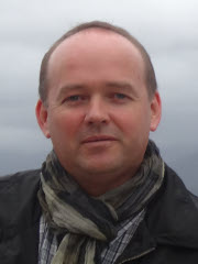 |
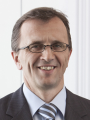
Piotr Wężyk, Laboratory of Geomatics, University of Agriculture in Krakow, Poland: “Making the invisible visible – the DTM modelling in complex environment” |
 |
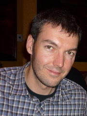
Manfred Zink, Microwaves and Radar Institute, German Aerospace Center, Oberpfaffenhofen, Germany: “TanDEM-X: A Challenging Radar Mission for Generating a New Earth’s Topography” |
 |
Christopher Crosby, Open Topography Group, United States: “OpenTopography: Enabling Online and On-Demand Access to High-Resolution Topography Data for Natural Hazards” |
 |
Tomasz Niedzielski, Institue of Geography and Regional Development, University of Wrocław, Poland: “Hydrological forecasting in real time: an experimental integrated approach” |
 |
Steve Kopp, Environmental System Research Institute, Redlands, CA, United States: “Expanding the reach of Geomorphometry through Web GIS” |
SCIENTIFIC COMMITTEE
- Alexander Brenning, University of Waterloo, Canada
- Lucian Dragut, West University of Timisoara, Romania
- Yongxin Deng, Western Illinois University, USA
- Ian Evans, Durham University, UK
- Igor V. Florinsky, Institute of Mathematical Problems of Biology, Russia
- Carlos H. Grohmann, University of Sao Paulo, Brazil
- Peter Guth, US Naval Academy, USA
- Michael Hutchinson, Fenner School of Environment and Society Canberra, Australia
- Steve Kopp, ESRI, USA
- Robert A. MacMillan, LandMapper Ltd, Canada
- Li Manchun, Nanjing University, China
- Jozef Minár, Comenious University, Slovakia
- Helena Mitasova, North Carolina State University, USA
- Brian Lees, University of New South Wales, Australia
- Wu Lun, Peking University, China
- Takashi Oguchi, University of Tokyo, Japan
- Scott Peckham, Rivix / University of Colorado, USA
- Sebastiano Trevisani, University Iuav of Venice, Italy
- Thomasz Stepinski, University of Cincinnati, USA
- Lynn Usery, USGS Center for Excellence for GIS, USA
- John P. Wilson, University of Southern California, USA
- Liu Xuejun, Nanjing Normal University, China
- Chenghu Zhou, Institute of Geographical Sciences and Natural Resources, CAS, China
- Qiming Zhou, Hong Kong Baptist University, Hong Kong
- A-Xing Zhu, Nanjing Normal University, China
Programme
DAY 1: Monday 22.06.2015
| 09:00-10:00 | REGISTRATION | |
|---|---|---|
| 10:00-10:30 | Welcoming remarks and technical information (Conference hosts, Chair and Vice-chair) |
|
| Session 1: DEM data sources Chair: Zbigniew Zwoliński |
||
| 10:30-11:00 | Invited lecture: Manfred Zink, Alberto Moreira TanDEM-X: A Challenging Radar Mission for Generating a New Earth’s Topography |
|
| 11:00-11:15 | Christopher Wecklich, Carolina Gonzalez, Benjamin Bräutigam Height Accuracy for the First Part of the Global TanDEM-X DEM Data |
|
| 11:15-11:30 | Carlos Grohmann ‘Radiography of the Amazon’ DSM/DTM data: comparative analysis with SRTM, ASTER GDEM |
|
| 11:30-11:45 | Piotr Wozniak High resolution elevation data in Poland |
|
| 11:45-12:00 | Shangmin Zhao, Li Wang and Wenjiao Wu Vertical error distribution of ASTER GDEM V2 data based on ICESat/GLA14 data:taking Shanxi Plateau of China as an example |
|
| 12:00-12:15 | COFFEE BREAK | |
| 12:15-12:45 | Keynote: Lucian Dragut Object-oriented geomorphometry |
|
| 12:45-14:00 | LUNCH BREAK | |
| Session 2: General Problems of Geomorphometry Chair: Guoan Tang |
||
| 14:00-14:30 | Invited lecture: Christopher Crosby OpenTopography: Enabling Online and On-Demand Access to High-Resolution Topography Data for Natural Hazards |
|
| 14:30-14:45 | Zbigniew Zwoliński and Joanna Gudowicz Geomorphometric analysis of morphoclimatic zones on the Earth |
|
| 14:45-15:00 | Vincent Lecours, Vanessa Lucieer, Margaret Dolan and Aaron Micallef An Ocean of Possibilities: Applications and Challenges of Marine Geomorphometry |
|
| 15:00-15:15 | Jozef Minar, Jozef Minar and Ian S. Evans Towards exactness in geomorphometry |
|
| 15:15-15:30 | Karin Ebert, Jerker Jarsjö and Karin Ekstedt Effects of future sea level rise – the example of the island of Gotland, Sweden |
|
| 15:30-15:45 | COFFEE BREAK | |
| Session 3: Geomorphometry in Geology and Geomorphology Chair: Ian Evans |
||
| 15:45-16:00 | Liyang Xiong and Guoan Tang Pre-Quaternary paleotopography reconstruction in the Ordos platform and its integration in the loess landform evolution modeling |
|
| 16:00-16:15 | Peter Guth Geomorphometry of Normal Faults: Abyssal Hills and Continental Rifts |
|
| 16:15-16:30 | Marco Bacenetti, Luca Ghiraldi, Marco Giardino and Luigi Perotti Analysis of morphometric index to evaluate the tectonic activity: case study from Germanasca valley (NW Italy) |
|
| 16:30-16:45 | Peter Bandura, Jozef Minár, Tatiana Harciníková and Lucian Drăguţ Towards delineation of the morphostructural division of the Western Carpathians using object-based image analysis |
|
| 16:45-17:00 | Yuichi S. Hayakawa, Hidetsugu Yoshida, Lucian Dragut and Takashi Oguchi Comparative analysis of manual and automatic extractions of hummock landforms in Mt. Gassan, northwestern Japan |
|
| 17:00-17:15 | Domenico Guida, Antonello Cestari, Alba Cuomo, Francesco Dramis, Vincenzo Palmieri and Vincenzo Siervo The Salerno University Geomorphological Informative Mapping System: the Licosa polygenetic case study (Cilento European geopark, southern Italy) |
|
| 17:30-19:00 | Poster Session Chairs: Jarosław Jasiewicz and Carlos Grohmann |
|
| 19:00-… | Geomorphometry society meeting (elections) |
Poster Session
| Day 1 Poster Session Chairs: Jarosław Jasiewicz and Carlos Grohmann |
|---|
| Cheng-Zhi Qin, Xue-Wei Wu, Yanjun Lu, Jing-Chao Jiang and A-Xing Zhu Case-based formalization of knowledge on digital terrain analysis |
| Magdy Torab and Nora Dalal Natural hazards mapping of mega waves on the NW coast of Egypt |
| Piotr Kłapyta and Natalia Kolecka Combining laser scanning with field mapping and Schmidt-hammer relative age dating - examples from the Babia Góra range (Westen Carpathians, Poland) |
| Aleksander Adamczyk, Marcin Sobiech, Agata Urbańska and Wojciech Wysota Geomorphometric analysis of glacial curvilineations (GCL) in Dobrzyń Lakeland, Central Poland |
| Lucas Ruiz and Xavier Bodin Analysis and improvement of surface representativeness of high resolution Pléiades DEMs: Examples from glaciers and rock glaciers in two areas of the Andes |
| Ruqiao Jiang and Guoan Tang A Method of Depression Filling with Consideration of Local Micro-relief Features |
| Marcin Brach and Jarosław Chormański Comparison of digital elevation models of riparian wetland generated from airborne laser scanning of different accuracy |
| Edina Józsa Extracting possible terrace surfaces from digital elevation models – methodological issues and case study from Hungary |
| Ângelo Moura Araújo, Paulo Pereira, Renato Henriques and Diamantino Pereira Water resources assessment using GIS procedures: application in Ceará State (Brazil) |
| Adriana Sărășan and Lucian Drăguț Assessing contextual information from SRTM data as abasis for classifying landform types. Case study: dune fields |
| Maciej Hajdukiewicz The potential accuracy of the survey of landform changes using archival orthophotos: case study of the Białka River valley |
| Milena Różycka, Aleksandra Michniewicz, Piotr Migoń and Marek Kasprzak Identification and morphometric properties of landslides in the Bystrzyckie Mountains (Sudetes, SW Poland) based on data derived from airborne LiDAR |
| Małgorzata Mazurek Geomorphometric attributes of channel heads initiated by seepage erosion in a postglacial zone (NW Poland) |
| Virginia Ruiz-Villanueva, Markus Stoffel and Hanna Hajdukiewicz Understanding large wood deposition during floods: a modelling approach |
| Cezary Kaźmierowski, Jakub Ceglarek,Jerzy Cierniewski, Jarosław Jasiewicz, Sławomir Królewicz, Michał Wyczałek Soil surface roughness quantification using DEM obtained from UAV photogrammetry |
| Barbara Czajka, Adam Łajczak and Ryszard J. Kaczka The influence of asymmetrical slopes on timberline course at Babia Gora Mountain (Western Carpathians) |
| Joanna Gudowicz Effects of DEM quality on SWAT model stream flow and sediment simulation |
| Ling Jiang, Guoan Tang and Chun Wang Extraction and analysis of loess gully heads based on grid terrain datasets |
| Mateusz Kędzior and Jarosław Zawadzki Comparison of three Topographic Wetness Indices against soil moisture estimates over Vistula basin |
| Ryszard J. Kaczka, Michał Lempa, Katarzyna Stachniak, Barbara Czajka and Zofia Rączkowska The geometry of timberline as an indicator of active and inactive avalanche paths |
| Zbigniew Zwoliński and Estera Stefańska Relevance of moving window size in landform classification by TPI |
| Zbigniew Zwoliński and Ewa Sznigir Spatial distribution of hypsometric curves within the Parsęta River drainage basin (Poland) as a geoindicator of geomorphological hazards |
DAY 2: Tuesday 23.06.2015
DAY 3: Wednesday 24.06.2015
| Session 8: Novel approches in geomorphometry Chair: Steve Kopp |
|
| 9:00-9:30 | Invited lecture: Tomasz F. Stepinski, Jaroslaw Jasiewicz, Pawel Netzel and Jacek Niesterowicz Doing Geomorphometry with Pattern Analysis |
| 9:30-9:45 | Przemysław Stpiczyński, Dominik Szałkowski, Leszek Gawrysiak and Łukasz Chabudziński Hybrid implementation of evaluation of primary topographic parameters using GPU-accelerated clusters |
| 9:45-10:00 | Sergio Camiz and Maurizio Poscolieri Geomorfo: a program for the classification of terrain units |
| 10:00-10:15 | Jarosław Jasiewicz, Alfred Stach, Jakub Nowosad Terrain misclassification problem – analysis using pattern simulation approach |
| 10:15-10:30 | Anita Bernatek Visualizing morphometric changes in a piping system using DEM and GIS analysis: the Bieszczady Mts., Poland |
| 10:30-10:45 | COFFEE BREAK |
| Session 9: Monitoring of natural hazards I Chair: Marco Giardino |
|
| 10:45-11:00 | Charles Jackson Caution: dust storms may do exist (and so do mountains): Modeling dust source suitability within an object-oriented geoecology |
| 11:00-11:15 | Viktor Kaufmann and Andreas Kellerer-Pirklbauer Regional quantification of rock glacier movement in Central Austria using governmental GIS data |
| 11:15-11:30 | Rafal Wawer and Artur Lopatka Thermal satellite scenes in single event modelling of wind erosion |
| 11:30-11:45 | Vaclav Petras, Helena Mitasova and Anna Petrasova Mapping gradient fields of landform migration |
| 11:45-12:00 | COFFEE BREAK |
| 12:00-12:30 | Keynote: Marco Giardino, Luigi Perotti, Walter Alberto, Sara Ratto Multidimensional approach to natural instabilities in mountain areas: how geomorphometry can improve both hazard modelling and risk perception |
| 12:30-13:45 | LUNCH BREAK |
| Session 10: Monitoring of natural hazards II Chair: Marco Giardino |
|
| 13:45-14:15 | Invited lecture: Steve Kopp [Expanding the reach of Geomorphometry through Web GIS |
| 14:15-14:30 | Janusz Wasowski, Fabio Bovenga, Raffaele Nutricato, Davide Oscar Nitti and Maria Teresa Chiaradia High resolution satellite SAR multi temporal interferometry for regional scale detection of landslide and subsidence hazards |
| 14:30-14:45 | François Clapuyt, Veerle Vanacker, Kristof Van Oost and Fritz Schlunegger Very-high resolution monitoring of movement of surface material within a landslide |
| 14:45-15:00 | Xavier Bodin, Dario Trombotto and Alvaro Soruco Evaluation of a terrestrial photogrammetry method for the study of high mountain dynamics. Quebrada del Medio rock glacier, Mendoza, Argentina |
| 15:00-15:15 | COFFEE BREAK |
| Session 11: Geomorphometry for natural hazards geomodeling Chair: Piotr Weżyk |
|
| 15:15-15:30 | Mario Kummert and Reynald Delaloye Quantifying sediment transfer between the front of an active alpine rock glacier and a torrential gully |
| 15:30-15:45 | Rafał Kroczak and Tomasz Bryndal An attempt to assess the influence of road network on flash flood wave parameters. The case study of the Carpathian Foothills |
| 15:45-16:00 | Mihai Niculita Automatic extraction of landslide flow direction using geometric processing and DEMs |
| 16:00-16:15 | Daniele Strigaro, Massimiliano Moretti, Matteo Mattavelli, Mattia De Amicis, Valter Maggi and Antonello Provenzale Development of GIS methods to assess glaciers response to climatic fluctuations: a Minimal Model approach |
| 16:30-17:15 | Life achievement awards / Best paper awards Towards Geomorphometry 2017 |
| 17:15– | Short Trip: Meteorite crater Morasko |
DAY 4: Thursday 25.06.2015
Parrallel workshops
| Room | Morning 9:00-12.30 |
Afternoon 13:30-17:00 |
| Jarek Jasiewicz GRASS GIS and R as a tool for large-scale geomorphometric mapping |
Jarek Jasiewicz, Markus Metz Hydrological modeling in GRASS GIS |
|
| Jonathan de Ferranti/Jacek Niesterowicz World-wide DEM |
Tom Hengl Automated DEM data analysis using R + SAGA + Google Earth |
|
| ESRI ESRI ArcGIS Pro – new desktop application from Esri |
ESRI ESRI ArcGIS Pro – new desktop application from Esri |
|
| Martin Isenburg Hands-on intro to LiDAR processing with LAS tools |
Fabio Bovenga, Janusz Wasowski Radar interferometry for ground motion analysis |
DAY 5: Friday, 8:00 A.M 26.06.2015
All-day conference trip
Adam Mickiewicz Square, City Centre near Adam Mickiewicz Monument
Mirosław Makohonienko, Małgorzata Mazurek
