Published: Aug 20, 2009 by ISG Board
Start: Aug 31 2009 - 09:15End: Sep 2 2009 17:30
Timezone: Europe/Amsterdam
Programme
Monday 31.08.2009
Tuesday 1.09.2009
Wednesday 2.09.2009
Published: Aug 20, 2009 by ISG Board
Start: Aug 31 2009 - 09:15End: Sep 2 2009 17:30
Timezone: Europe/Amsterdam
Monday 31.08.2009
Tuesday 1.09.2009
Wednesday 2.09.2009
Share
Latest Posts
Dear geomorphometry community,
We are pleased to invite submissions for a cover design contest for the second edition of the Geomorphometry book, to be published in 2026.
The submissions will be gathered in a poll, and the entire community will be able to vote for their favorite design.
If your design is selected, you will receive the appropriate credits, but would need to provide the necessary permissions to use the image.
You can submit your design by email before October 17th. Please ensure that the image is of at least 300 dpi resolution.
Get designing!
The editors,
Hannes Reuter
Carlos Grohmann
Vincent Lecours
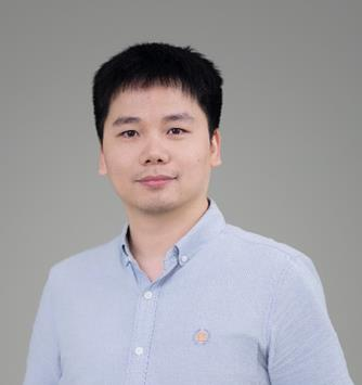
Recent Research Progress in Geomorphometry in China
Dr. Li-Yang Xiong
Nanjing Normal University, China
October 1st , 2025
8:00 MDT (UTC -6), 10:00 EDT (UTC -4), 11:00 BRT (UTC - 3), 15:00 BST (UTC +1), 16:00 CEST (UTC +2), 17:00 EEST (UTC +3), 22:00 CST (UTC +8)
Recording available in our YouTube channel
Bio: Dr. Li-Yang Xiong is a professor at the School of Geographical Science, Nanjing Normal University (NNU), China. He is currently responsible for managing NNU’s research in Digital Terrain Model and Digital Terrain Analysis. His main research interests include AI based terrain modelling, loess terrain feature characterization, landform evolution modeling, paleotopography reconstruction and geomorphological process mining. His recent work involves deep learning-based DEM reconstruction, geomorphology-oriented digital terrain analysis, and value-added digital terrain applications for geoscience. He also serves as Associate Editor for the journal Earth Surface Processes and Landforms and as an Editorial Board Member for International Journal of Geographical Information Science.
Abstract: In this talk, I will present some recent research achievements related to terrain modelling theory, terrain analysis method and terrain application in China. This terrain modeling theory focused on how we understand terrain knowledge and integrate it into AI methods for terrain reconstruction. In term of the terrain analysis method, the mathematical vector operation we believe should be highlighted in the research of Geomorphometry, which is suitable for multi-source data structure by considering the directional property of terrain parameters. Actually, this directional property should be made a full consideration for process- oriented geographical modeling and simulation. Lastly, I will show some terrain applications towards different typical geographical areas in China as well as global scale application.
Dear colleagues,
I’m grateful if you can circulate information on this PhD opportunity in Italy. The potential candidates can contact me (strevisani@iuav.it) for further information. Here the main elements of the position:
Research topics: Predicting and supporting benthic and pelagic biodiversity through geomorphometry and machine learning
Link to the call (Italian and English): https://www.unipa.it/didattica/dottorati/dottorato-xli/bando-di-accesso-ciclo-41/
Position code [BIODIV.OGS]
Research headquarters OGS Trieste and University of Palermo
Funded by OGS - Istituto Nazionale di Oceanografia e di Geofisica Sperimentale
Key dates: Deadline: 7th August 2025 - 14:59 (Italian time)