Geomorphometry 2023 - Venue

Published: Jan 15, 2023 by ISG Board

Conference Venue

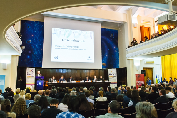
“Mihai Eminescu” Aula Magna of “Alexandru Ioan Cuza” University of Iasi

Total capacity: 426 seats, of which 258 are on the ground floor and 168 are on the balcony.

Facilities: laptops; video projection; 7 static microphones – desk; 2 portable microphones; Wireless sound amplification system (2x300 W); Reflectors; the possibility of organizing cocktails and coffee breaks, etc.

See the exact location on Google maps: https://goo.gl/maps/JnGCZXyoJkCfEWGbA

Workshops

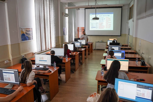
For the workshops, PC rooms from the Department of Geography, Faculty of Geography and Geology will host the attendees.

Posters

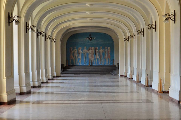
For the posters, there is the Hall of the Echoing Footsteps (https://www.uaic.ro/en/about-uaic/hall-echoing-footsteps/ and the virtual tour https://www.uaic.ro/despre-uaic/prezentare-sala-pasilor-pierduti/), adjacent to the Aula Magna: https://goo.gl/maps/T5VEtcmGWUnS7gLt9

Fieldtrip

The one-day field trip will be an enjoyable itinerary through the Moldavian Plateau, the Romanian Subcarpathians, and the Romanian Carpathians. Geosites, wineries, monasteries, and natural parks will be visited, while geomorphometricians will network, make friends and spend a good time.

story event Iasi Romania

Share

Latest Posts

ANADEM: A Digital Terrain Model for South America

There is a new paper (open access) describing a Machine Learning-based DTM for South America:

Laipelt L., Andrade B.C., Collischonn W., Teixeira A.A., Paiva R.C.D., Ruhoff A., 2024. ANADEM: A Digital Terrain Model for South America. Remote Sensing 16(13):2321. https://doi.org/10.3390/rs16132321

GRASS GIS 8.4.0RC1 release

The GRASS GIS 8.4.0RC1 release provides more than 515 improvements and fixes with respect to the release 8.3.2.

Check the full announcement at https://github.com/OSGeo/grass/releases/tag/8.4.0RC1.

Please support in testing this release candidate.

Best BiCubic Method to Compute the Planimetric Misregistration between Images with Sub-Pixel Accuracy: Application to Digital Elevation Models

There is a new paper (open access) describing a novel method to estimate sub-pixel planimetric displacements between two DEMs:

Riazanoff, S.; Corseaux, A.; Albinet, C.; Strobl, P.A.; López-Vázquez, C.; Guth, P.L.; Tadono, T. Best BiCubic Method to Compute the Planimetric Misregistration between Images with Sub-Pixel Accuracy: Application to Digital Elevation Models. ISPRS Int. J. Geo-Inf. 13, 96. https://doi.org/10.3390/ijgi13030096