Digital Elevation Models (DEMs): Terminology and Definitions

Published: Sep 16, 2021 by ISG Board

There is a new paper on DEM terminology and definitions (open access):

Guth, P.L., Niekerk, A.V., Grohmann, C.H., Muller, J.-P., Hawker, L., Florinsky, I.V., Gesch, D., Reuter, H.I., Herrera-Cruz, V., Riazanoff, S., Lópéz-Vázquez, C., Carabajal, C.C., Albinet, C., Strobl, P., 2021 - Digital Elevation Models: Terminology and Definitions. Remote Sensing, 13(18):3581. https://doi.org/10.3390/rs13183581

The paper is the first major contribution of the DEMIX project (DEM Intercomparison EXercise). The idea is to “consolidate terminology and definitions of key concepts to facilitate a common understanding among the growing community of DEM users, who do not necessarily share the same background”.

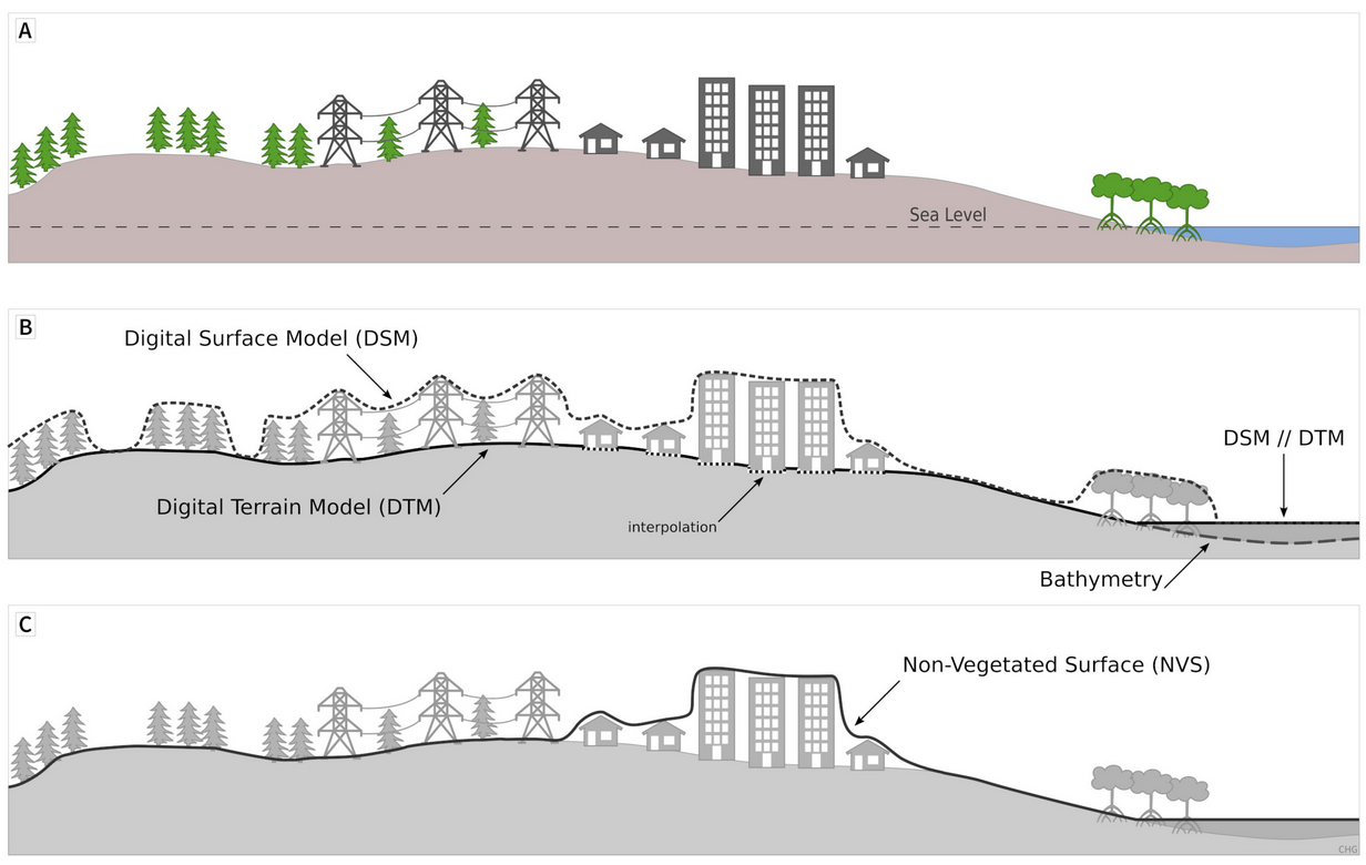
Scheme showing the surfaces represented by a DSM, a DTM, and a NVS (Guth et al., 2021)

story srtm aster alos fabdem nasadem copdem copernicus publication demix

Share

Latest Posts

ANADEM: A Digital Terrain Model for South America

There is a new paper (open access) describing a Machine Learning-based DTM for South America:

Laipelt L., Andrade B.C., Collischonn W., Teixeira A.A., Paiva R.C.D., Ruhoff A., 2024. ANADEM: A Digital Terrain Model for South America. Remote Sensing 16(13):2321. https://doi.org/10.3390/rs16132321

GRASS GIS 8.4.0RC1 release

The GRASS GIS 8.4.0RC1 release provides more than 515 improvements and fixes with respect to the release 8.3.2.

Check the full announcement at https://github.com/OSGeo/grass/releases/tag/8.4.0RC1.

Please support in testing this release candidate.

Best BiCubic Method to Compute the Planimetric Misregistration between Images with Sub-Pixel Accuracy: Application to Digital Elevation Models

There is a new paper (open access) describing a novel method to estimate sub-pixel planimetric displacements between two DEMs:

Riazanoff, S.; Corseaux, A.; Albinet, C.; Strobl, P.A.; López-Vázquez, C.; Guth, P.L.; Tadono, T. Best BiCubic Method to Compute the Planimetric Misregistration between Images with Sub-Pixel Accuracy: Application to Digital Elevation Models. ISPRS Int. J. Geo-Inf. 13, 96. https://doi.org/10.3390/ijgi13030096