Published: Mar 20, 2020 by C.H. Grohmann
Github repository containing scripts and associated supplemental material (csv files, etc) for the paper:
Grohmann,C.H.; Garcia,G.P.B.,; Affonso,A.A; Albuquerque,R.W., 2020. Dune migration and volume change from airborne LiDAR, terrestrial LiDAR and Structure from Motion-Multi View Stereo. Computers & Geosciences, 143:104569.
View article at publisher (paywalled): http://doi.org/10.1016/j.cageo.2020.104569
Open Access preprint (same content as article, different formatting): https://arxiv.org/abs/1910.06186
Link to GitHub repository: https://github.com/CarlosGrohmann/scripts_papers/tree/master/garopaba_als_sfm_tls
This paper presents an evaluation of Structure from Motion-Multi View Stereo (SfM-MVS) to obtain high-resolution elevation data of coastal sand dunes based on images acquired by Remotely Piloted Aircraft (RPA).
The analyzes were made using GRASS-GIS trough python scripts. Denoising of SfM-MVS DEMs were made with WhiteBox. Although the DEMs cannot be shared in GitHub (due to space limitations), the scripts can be used as an educational resource.
The LiDAR and SfM-MVS datasets can be accessed at:
- Airborne LiDAR 2010 - available at OpenTopography: https://doi.org/10.5069/G9DN430Z
- Terrestrial LiDAR 2019 - available at OpenTopography: https://doi.org/10.5069/G9CN7228
- SfM-MVS 2019 - available at OpenTopography: https://doi.org/10.5069/G9DV1H19
- RPA images 2019 - available at GeoNadir: https://data.geonadir.com/image-collection-details/334
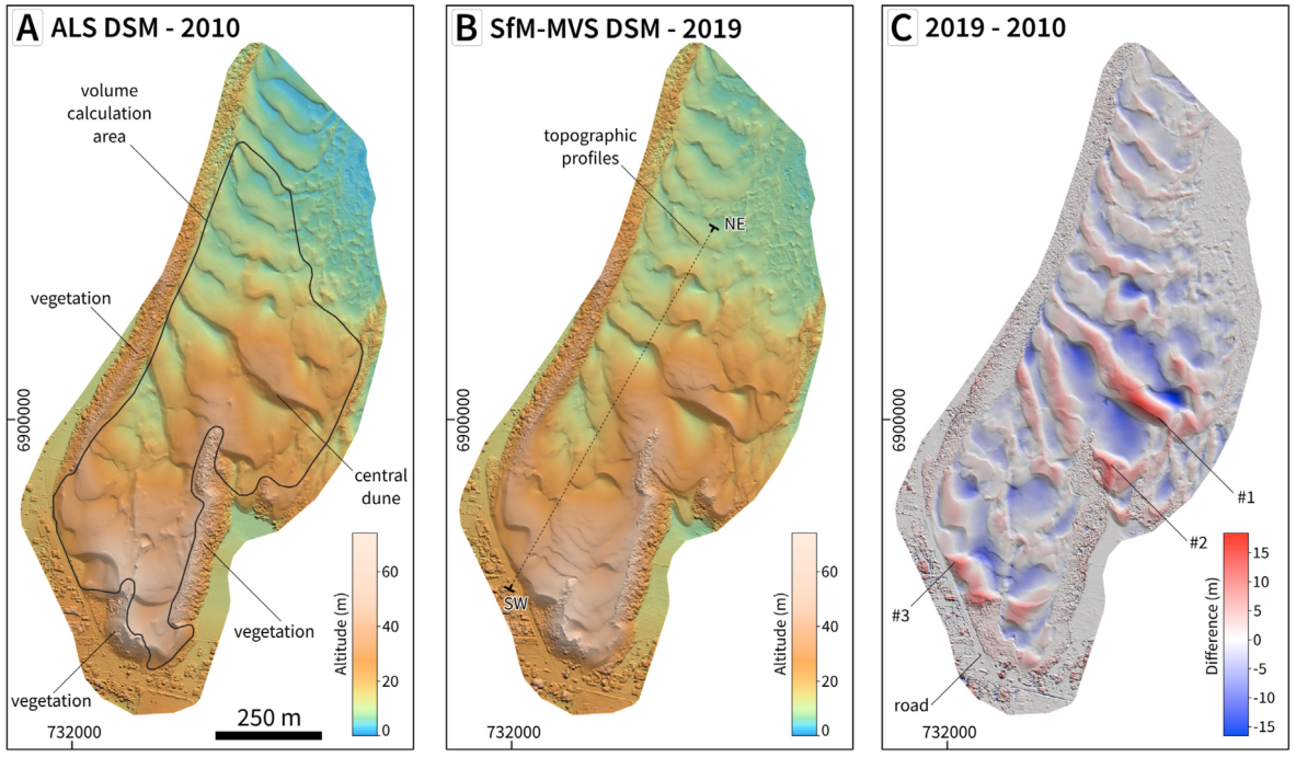
 Difference between LiDAR DEM (2010) and SfM-MVS DEM (2019) for the Garopaba dune field, in southern Brazil
This study was supported by the Sao Paulo Research Foundation (FAPESP), Brazil grants #2009/17675-5 and #2016/06628-0 and by Brazil’s National Council of Scientific and Technological Development, CNPq grants #423481/2018-5 and #304413/2018-6 to C.H.G.