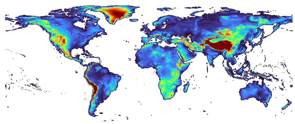
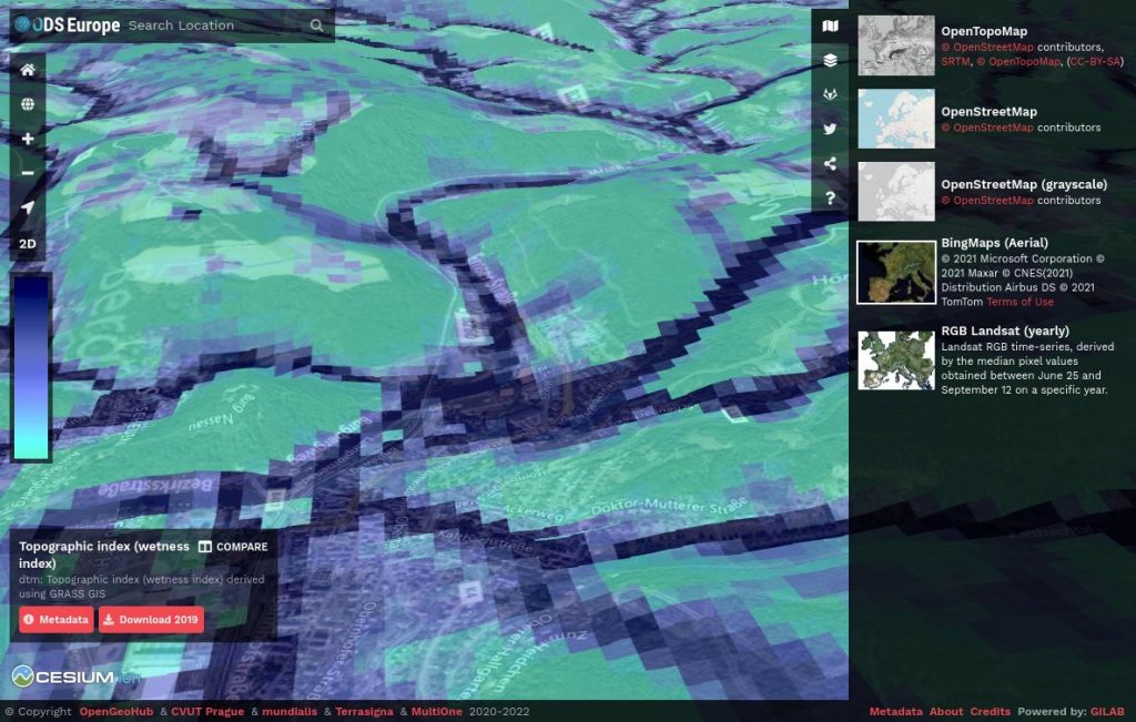
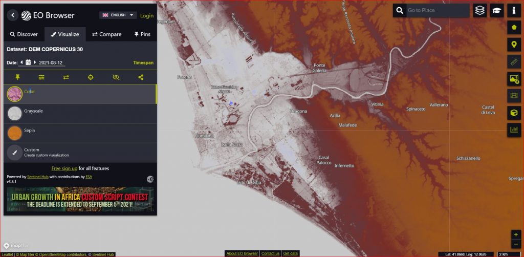
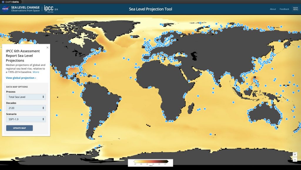
High-Resolution Topography Data and Tools Other open sources of elevation/topographic data:http://www.earthenv.org/DEM — EarthEnv-DEM90 (global; smoothed 90 m),http://www.eorc.jaxa.jp/ALOS/en/aw3d30/index.htm — ALOS AW3D30 (global height above sea level; 30 m resampled from 5 m),http://srtm.csi.cgiar.org — SRTM DEM tiles (near to global; 90 m),http://www.gdem.aster.ersdac.or.jp — GDEM tiles (global; ca 30-60 m),http://www.astrium-geo.com/worlddem/ — WorldDEM global at 12 m resolution and high vertical accuracy (+/-2-5 m),http://opentopography.org — High resolution topographic (LiDAR) data (regional/local; 1–10 m resolution),http://seamless.usgs.gov/website/seamless/viewer.htm – Seamless Data Warehouse (USGS),“Elevation” and geomorphometry services:https://developers.google.com/maps/ — Google Maps Elevation API / R package googlewayhttps://open.mapquestapi.com/elevation/ — elevation services,http://www.arcgis.com — ESRI Elevation layers,http://scalgo.com — global DEM-based hydrological services,Datasets can also be shared via the ArcGIS On-line web-service (see “Geomorphometry” group). Posted by Yu-Feng Ho February 14, 2023 28 min read An Ensemble Digital Terrain Model of the world at 30 m spatial resolution (EDTM30) Prepared by: Yu-Feng Ho (OpenGeoHub), Tom Hengl (OpenGeoHub) and... Data sets Scripts Read More Posted by tom.hengl August 12, 2021 4 min read Continental Europe Digital Terrain Model at 30 m resolution based on multisource data Within the OpenDataScience.eu (Geo-harmonizer) project we have recently produced... Data sets Publication Read More Posted by tom.hengl August 12, 2021 2 min read Copernicus Digital Elevation Model (DEM) as Open Data on Amazon AWS and Sentinel-Hub European Space Agency (ESA) has recently made available two... Data sets Story Read More Posted by tom.hengl August 12, 2021 3 min read NASA Sea level projection tool NASA has recently released an interactive webmapping tool to... Data sets Story Read More Posted by tom.hengl July 20, 2021 6 min read Zlatibor Zlatibor Zlatibor Serbia 43° 43' 0.0012" N, 19° 41' 60" E Data sets Read More Posted by tom.hengl July 20, 2021 4 min read Volcano Maungawhau Volcano Maungawhau Auckland New Zealand 36° 50' 50.586" S, 174° 45' 56.646" E Data sets Read More 12